
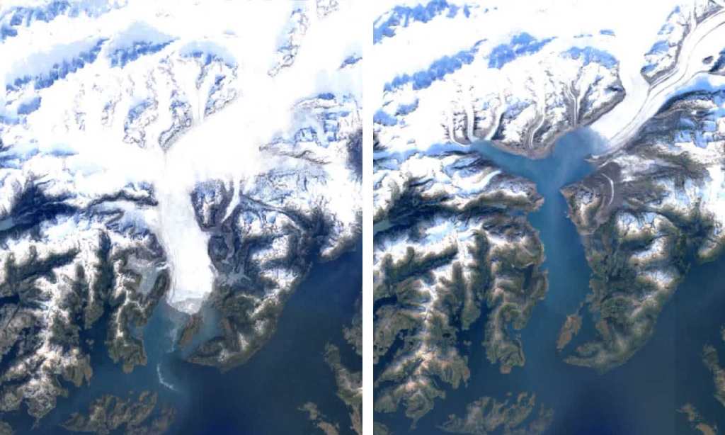
Google Earth has a new Timelapse feature, that allows us to observe how Earth has changed from 1984 to 2020, showing just how much the devastating effects of climate change have already shaped the geography of our planet.
“It’s best for a landscape view of our world,” Rebecca Moore, director of Google Earth, Google Earth Engine, and Google Earth Outreach said. “It’s not about zooming in. It’s about zooming out. It’s about taking the big step back. We need to see how our only home is doing.”
This new feature marks the biggest update to Google Earth since 2017, showcasing our planet across an entirely unexplored dimension – time. In order to build this feature, 24 million satellite photos from the past 37 years have been compiled into an interactive 4D experience as you watch time literally unfold to show four decades of change.
The feature, titled ‘Timelapse’ is now available on Google Earth. To access it, click on the Voyager tab in Google Earth (it’s the icon that looks like a ship’s wheel). Using this tool, you can search a place of interest to you and see how it’s changed since 1984, or you can check out one of Google’s guided tours about forest change, urban growth, warming temperatures, mining and renewable energy sources, and “the Earth’s fragile beauty.”
Google has also uploaded over 800 timelapse videos in 2D and 3D versions, which you can watch on YouTube. Prepare to feel a number of things in watching the videos, from marvel and wonder, to grief and sadness.
From government bodies to researchers, publishers to teachers and advocates, it will be fascinating to see how Google Earth’s Timelapse will be used and reacted to. With any hope, the visuals will help to inspire real change and climate action. We need it.
Read more stories from The Latch and subscribe to our email newsletter.