
Australia seems to exist on a rapidly expanding pendulum swing from too wet to too dry — such is the joy of climate change. With La Niña having given us a good drenching for the past three years, the memories of the catastrophic Black Summer fires almost seem like an alternate reality.
However, with La Niña finally hanging up her coat, we should expect relatively ‘normal’ weather conditions to start returning over the next few months. The latest data from the Bureau of Meteorology suggest that La Nina is “anticipated to ease over summer.”
“La Niña continues in the tropical Pacific, but is slowly weakening,” the BOM states.
“Long-range forecasts suggest that tropical Pacific Ocean temperatures will continue to warm towards ENSO-neutral levels over the coming weeks, with some change in atmospheric patterns towards neutral levels also possible,” they add.

The BOM has advised that around 40% of previous La Nina events have switched to El Nino events in the same year, potentially bringing with it intense heat, prolonged sun, and drought. Australia has already warmed by 1.47 degrees, and scientists are warning that this could bring about more extreme weather that flips from one end of the spectrum to the other.
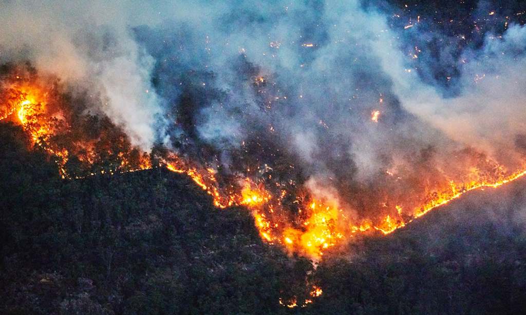
This brings us to our next climactic fear: fire. Australia’s bushfire season varies across the country, officially running from November 1 to March 16 in the ACT, but running through the dry season of winter and into spring in Western Australia and the Northern Territory. However, last year, the CSIRO published a study showing that Australia’s fire season has extended by an average of 27 days since the 1970s.
In a typical year, some one million hectares of eucalyptus forest will burn across the country, something that is also increasing under climate change.
Still, with all of the wet weather around this year, it looks like we’re in for a fairly mild bushfire season this summer. Australasian Fire and Emergency Service Authorities Council’s (AFAC) Seasonal Bushfire Outlook for this year has described the conditions as “varied.”
With lots of extra plant material around thanks to the heavy rainfall, the AFAC have said that warmer, drier conditions in late summer could increase the risk of fires.
“Above normal” fire potential is expected in central parts of the country, including WA, southern Queensland, and inland NSW. This is also the case for western Tasmania.
Most of Victoria, NSW, and the ACT however have “below normal” fire potential this summer as rainfall is still expected across much of this region.

The above assessment mirrors what Emergency Services Australia Commissioner Georgina Whelan has said about the fire risk in the ACT and surrounding areas.
“With the recent rainfall, we anticipate the bushfire risk will remain low throughout November and December,” she said.
“However, when the weather warms up, we will see the grass begin to dry out, bringing an increased risk of fast-moving grass fires.”
So, while we may start the season on a quiet note, authorities are warning that toward the end of the season we could start seeing more of a risk of fire.
The BOM has said that bushfires can happen at any time of the year and that climate change will see an increase in length and severity of the season.
“Bushfire weather conditions in future years are projected to increase in severity for many regions of Australasia, including due to more extreme heat events, with the rate and magnitude of change increasing with greenhouse gas concentrations (and emissions),” they said.
Related: Do You Have ‘Weather Fatigue’? You’re Not the Only One, But It Can Be Conquered
Related: Our La Niña Might Rain On Your Christmas Day Parade — A State-by-State Guide
Read more stories from The Latch and subscribe to our email newsletter.